News
Advancing Regenerative Agriculture With Skytec’s Ranger And Limestone Valley RC&D
Skytec News
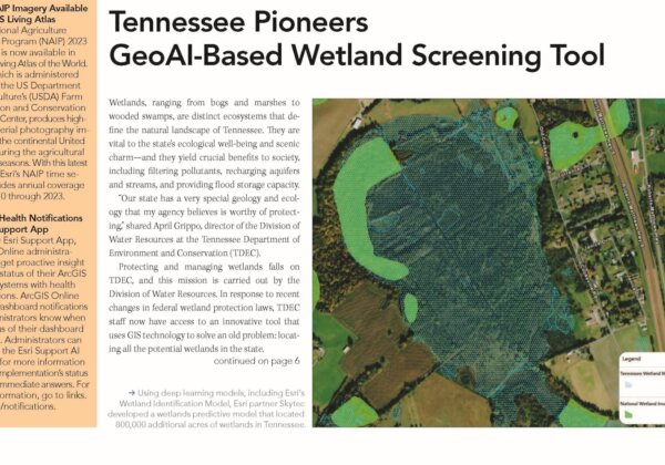
Tennessee Pioneers GeoAI-Based Wetland Screening Tool
Skytec featured in the Spring 2025 issue of ArcNews for collaboration with the Tennessee Department of Environment and Conservation (TDEC) on the Tennessee Wetland Screening Tool.
Read More
International Paper and Skytec Honored with Special Achievement in GIS Award
GIS Technology Provider Esri Recognized International Paper and Skytec at Annual User Conference for their collaboration on ForSite® project.
Read More
Advancing Regenerative Agriculture With Skytec’s Ranger And Limestone Valley RC&D
How much does healthy soil impact our climate resiliency? It turns out quite a lot. Optimizing best practices in land management can increase biodiversity, enrich soil, and protect water quality, ultimately making our soil more resilient to climate instability. This practice, known as regenerative agriculture, is a critical tool for agriculture experts all over the world.
Read More