Monitor What Matters™
Leverage powerful remote sensing, automated change detection and monitoring, and GIS technologies to better manage and meet commitments.
The Problem
Around the globe and across industries, businesses face a dilemma—how do we best monitor and manage natural resources in this era of rapid environmental change?
What if you had access to accurate, up-to-date geospatial data at your fingertips?
In a complex and changing environment, the right information at the right time can inform better resource management and limit adverse environmental impacts. With the right intelligence, you can monitor what matters.
The Solution
We harness the power of the latest geospatial, AI, and remote sensing technologies to provide our clients with actionable, near-real-time analytics.
Skytec creates customized geospatial mapping and analytics solutions that are:
Scalable | Timely | Global
Uncover innovative solutions that pair and automate macro-scale sattelite-based monitoring and micro-scale, high-resolution verification with unmanned aerial systems.
Access a scalable global monitoring platform and a full scope of imagery products.
Integrate data into existing workflows and into enterprise systems.
Empower your organization, from the individual to enterprise, with actionable analytics that demonstrate environmental management commitments.
Relaible & Accurate Geospatial Analytics
Ranger™
Monitor What Matters™
A comprehensive change detection and monitoring solution.
Ranger empowers clients with the ability to proactively manage assets, steward resources, and meet commitments.
Learn MoreUnmanned
LiDAR and Photogrammetry
Our seasoned pilots maintain the operational expertise and knowledge to safely collect field data. Since 2015, Skytec has used the pinnacle of drone, sensors and software to provide its clients with premium, high-accuracy LiDAR and photogrammetry products.
Learn MoreGIS Professional Services
Custom Monitoring Solutions
How do you turn data into actionable information? It starts with an understanding of desired client outcomes and capabilities. At Skytec, we provide innovative solutions that bridge the deep divide between data and information.
Learn MoreSkytec News
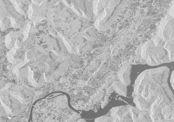
Skytec Expands Service Offerings through SAR Technology
Asset monitoring doesn't wait for sunny days and blue skies. With synthetic aperture radar on the horizon, Skytec will be able to deliver satellite imagery and data in all weather environments.
Read More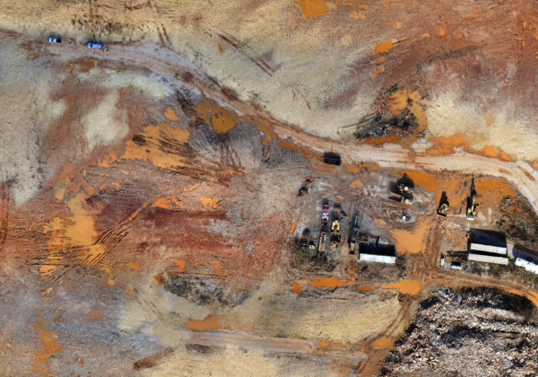
The Benefits of High-Quality Aerial Photogrammetry
Skytec serves clients the latest technology and expertise to acquire unique data relevant to a worksite. With services and technology that harness the power of LiDAR, aerial photogrammetry, and satellite imagery, Skytec delivers unparalleled precision and accuracy with its data insights.
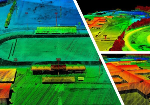
UAS LiDAR + Surveying Work: Skytec Supports Surveyors with Dynamic Data Capture
When precision in mapping matters, geospatial imagery and data gathered through UAS delivers efficient, effective data for professional land surveyors and surveying clients. With an experienced team, dynamic fleet of aircraft and sensors, and GIS expertise, Skytec brings advanced geospatial mapping capabilities to surveyors.
Read More